Map Mode
Map Mode is a view mode which optimizes the display of large maps. It has very little effect on small areas and it only applies to your current 2D view.
When the view's eyepoint height is higher than a certain value calculated from the screen resolution, or calculated from the Print Layout dpi value, Map Mode will:
- paint sections using the Functional Class attribute (unless a Style is applied)
- filter geographical objects based on length, area, and Functional Class.
To turn Map Mode on and off:
- On the main menu, select View > Map Mode (a tick is displayed next to the menu item).
- Repeat step 1 to turn Map Mode off.
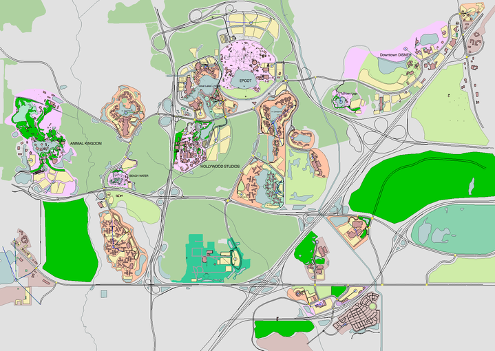
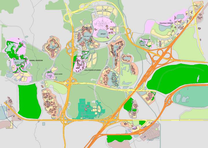
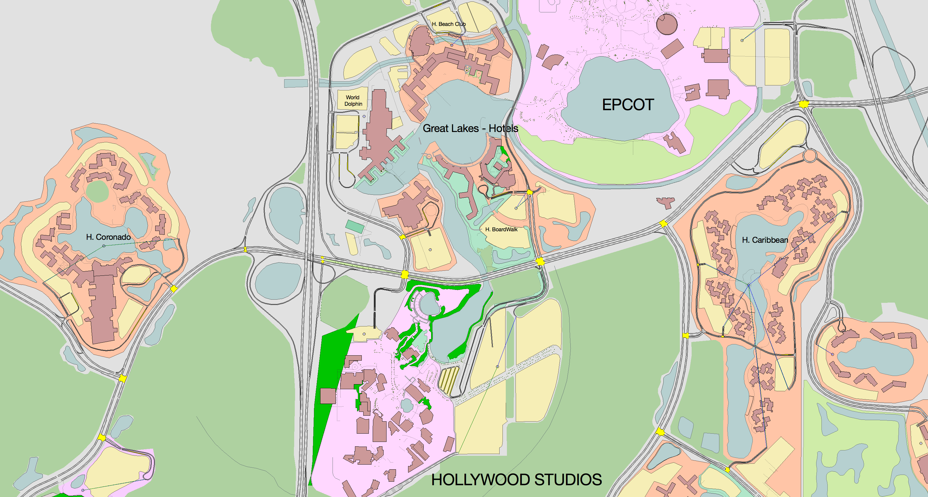
The three examples below demonstrate the effect of Map Mode. The top screenshot shows the map without Map Mode selected. The middle screenshot uses Map Mode but for a display with four times the resolution of the previous view. The bottom image shows a cropped area so that you can see the differences more clearly.